On-the-fly reporting by a single asset, groups of assets, or an entire fleet provides the ability to set reporting cadence to align with and support operational requirements, and a historical replay for after-action review and analysis, supporting enhanced customer service and accountability.
The customer can load their own Area of Operations (AO) map data which provides customization while minimizing integration costs.
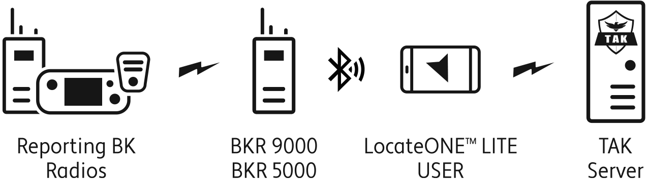
Real-time tracking of broadband cellular devices and BK radios simultaneously on one platform eliminates the need for multiple tracking solutions.
The LocateONETM platform is integrated with Esri ArcGIS in a common operational picture to integrate real-time data into an organization’s GIS map for an off-the-shelf solution. This enables Esri users to deploy cost-effective ArcGIS solutions quickly, without long and expensive integration efforts.